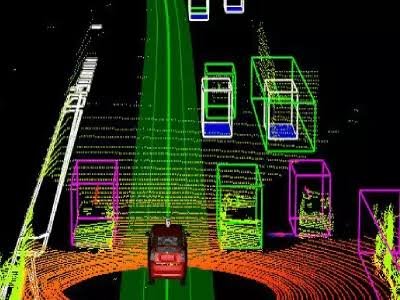
3D Point Cloud Annotation
Expert handling, navigation, and labeling of dense, high-resolution 3D point cloud datasets captured from advanced LiDAR sensors.
Precise spatial tagging of millions of individual data points to create highly detailed, accurate environmental maps for machine learning.
Utilization of advanced 3D annotation platforms featuring multi-angle and orthogonal views for unparalleled depth and structural accuracy.
Sequential frame annotation to track moving objects across time, which is critical for trajectory prediction and autonomous driving models.
Tailored datasets engineered to power complex AI applications in autonomous vehicles, smart city planning, and topographical mapping.